| ||||||||||||||||||||||||||||||||||||||||||||||||||||||||||||||||


The Cultural Landscape of Prácheňsko, Czech Republic
The Prácheňsko Project
|
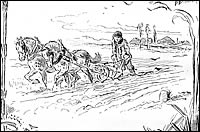
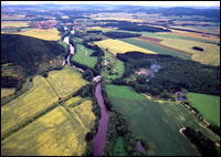
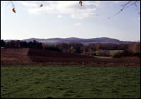
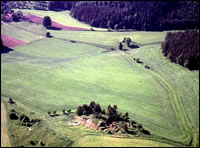
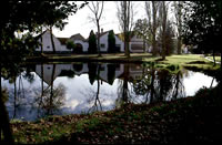
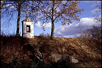
The selected landscape - the northern Prachensko region of South Bohemia in the Czech Republic - fosters a typical, hilly, wooded agricultural mosaic lying 400-600m above sea level. To the east and south the region is bordered by the rivers Vltava (Moldau) and Otava, to the north by the Brdy range, and to west by the Plana plains. The main aim of the project is to gain an understanding of the evolution of a specific type of cultural landscape from prehistoric to recent times, and, if possible, of the social transformation associated with it. The project will discern the fundamental factors, structures and changes in the settlement of one specific landscape type, namely the northern Prachensko region. It will also elucidate the position of similar types of natural environment in bands between fertile lowlands and uplands in prehistoric, Medieval and Early Modern development. The present, somewhat biades picture of prehistoric settlement is the result of several independent factors, including the limited archaeological investigation of the area, and the diverse and archaeologically less visible manifestations of prehistoric cultures based on differing economic systems or different natural conditions, which make the recovery of archaeological findings more difficult. This region of incontestable natural appeal is at present most threatened by thoughtless interventions on the part of its inhabitants, who in the course of fifty years under a Communist political regime lost both ownership of the land and a feeling of responsibility towards the landscape and environment surrounding them. ResearchThanks to links with existing projects, the proposed program will be able to make use of the most modern methods and approaches - aerial photography, GIS, GPS, computerized data analysis, geophysics etc. CommunicationCommunication with both the general public and special interest groups in the form of presentation of the project results (educational archaeological and historical walking trails, internet support, promotional materials). Another kind of presentation is improving the accessibility of archaeological maps of the region available on the Internet, educational trails and booklets, publication of results in monograph format, CD-ROM presentations and the exhibitions in regional museums. Related (co-operative) projects:The archaeological potential of Bohemia: the risks of intervention This project aims to present data and theoretical knowledge suitable for limiting the risk of unexpected intervention on archaeological sites. A method of predicting archaeological sites is proposed which considers both the wider environmental character of the region and local landscape features. The extensive use of GIS techniques is crucial to the project methodology. Settlement space in prehistoric Bohemia The goals are identifying of the settlement network in prehistoric Bohemia by means of aerial photography and other "non-destructive" techniques, studies on the natural environment, as well as research on demographic patterns and internal structure. All these factors are studied in their continuity over time, and the roots of changes affecting them. Netolice in its historic landscape A project encompassing the documentation and study of archaeological and architectural monuments in a typical South Bohemian landscape of lakes and pools, and the lost landscape of the Rozmberk enclosures (the decline of Rozmberk line) around the town of Netolice (southern Prachensko). A trilingual book has already been published; educational trails are being constructed.
Project team: Institute of Archaeology of the Czech Academy of Sciences, Prague ARCHEOS, Unit for archaeology and ancient monuments, Prachatice |
|

|
|
|
|
|