| ||||||||||||||||||||||||||||||||||||||||||||||||||||||||||||||||


The Cultural Landscape of Vakka-Suomi Region, Finland
Untamala Project
|
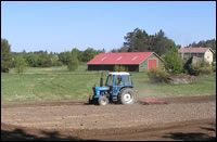
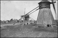
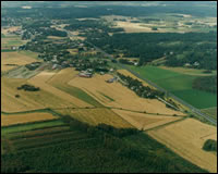
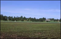
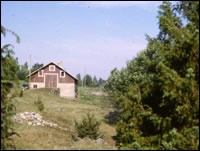
The Untamala project focuses on sustainable management of cultural landscapes. One of the main goals is to develop methods of communication between researchers, planners and public. The reactive measurements of protection - like raising the public awareness especially in young people - will be in central aspect. The area for this pilot project is a little village called Untamala situated in the Vakka-Suomi district, on the south western coast of Finland. Vakka-Suomi is a distinctive cultural area where cultivation and grazing have been practiced for about two thousand years. Open landscape, wooden buildings and diverse natural features are typical of the area. To develop management strategies for Untamala village and the whole Vakka-Suomi district it is important to understand how the cultural landscape has evolved, the changes it has undergone and which monuments require special protection. Studies on Untamala´s cultural environment and careful analysis of the landscape and its history are vital. When this knowledge is collected and analysed, the National Board of Antiquities will produce a touring exhibition for local schools and libraries. Also a booklet describing the development of the cultural landscape in Vakka-Suomi district will be published for the use in schools and for local habitants. A seminar or series of lectures on cultural heritage and its management will be given for landowners, landusers and planners. It is also important to provide information about ancient monuments and their accessibility for school-children, students and cultural oriented tourists. Flyers, marked paths between signposted monuments, maps and other informative media are planned to serve this purpose. Some of the monuments also need regular maintenance. Research A sound basis for environmental analyses is available in the rich source material of early maps made for cadastre. Beside historical maps, we can evaluate the changes in landscape and environment by analysing modern topographical maps. The information of ancient monuments and elements of human activity have already been collected and the observations will be entered to a database. The base maps and contour lines are needed for the GIS analysis. Communication Both physical and conceptual access to an area are necessary if one wants to protect cultural landscapes. It is much easier when people are interested in their environment and its history. To archive this, people must be given information and hands-on experience. Conceptual paths like books, exhibitions and web pages are used when someone needs more knowledge. Physical paths - e.g. like a network of signposted and well-maintained monuments - are used when exciting firsthand experiences are needed. The National Board of Antiquities wants to develop Untamala village as a demonstration area of reactive protection and sustainable management. To succeed in this we have to provide information about what exists in the area and guidelines for using the land and its management to the local inhabitants and authorities.
Project team: |
|
|
|
|
|
|